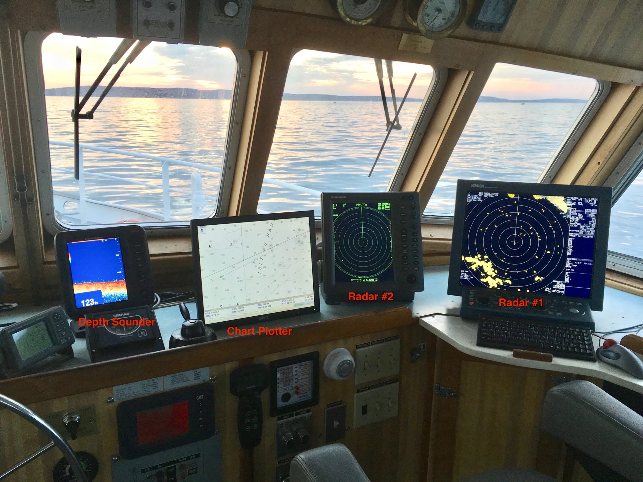
NORTHEAST HARBOR, Me — This is a photo of the Sunbeam V bridge. Our complement of electronic navigation equipment includes the following:
1) A chart plotter which presents a digitized copy of a marine chart into which our GPS location is inputted and plotted.
2) A depth sounder which shows the depth of the water beneath our keel and gives a general contour of bottom characteristics.
3) A primary radar (radar#1) which is a large commercial grade radar that presents surrounding “targets” on a large screen allowing for safe navigation in low visibility conditions such as fog and/or darkness.
4) A second smaller radar (radar#2) which is partially for redundancy and as a short range unit to keep track of “targets” that are difficult to discern on the larger radar.
Radar #2 is the piece of equipment that I am replacing.
It is over 10 years old. Radar technology has improved tremendously. Do you own a flat panel t.v.? Think of how much LCD screen technology has imrpoved.
The resolution of the older radar screen is marginal and can cause distortion of smaller targets such as boats and bouys. A newer unit is much more crisp, with a zoom feature allowing the user to focus on a particular area of interest.
The other big improvement is advancement of what we call “hybrid” units that combine a chart plotter with a radar. This gives the user a feature called overlay that can project the radar image on top of the navigational chart. This can clear up a lot of doubt about radar targets without measuring the distance and range manually to determine if a target is say, a boat or a navigational aid.
Another plus of the new unit is Automatic Identification System (AIS) technology. AIS is essentially the marine equivalent of an airplane transponder which broadcasts ship information for other captains to use. The Sunbeam V’s position will be presented on a screen of other similarly equipped ships, and their information will be presented on our new unit.
Michael Johnson
Captain, Sunbeam V

